UPDATED, 19 April 2016: There is a gated section on the descent to the SF Alsea Rd. below Prairie Peak. This is a new red gate with a forbidding sign and cameras. One can get through, but doing so pretty clearly constitutes trespass.
This ride (gpx) starts at the bottom of Tobe Cr. and grinds up a steep 11 miles to the summit of Prairie Peak, then turns back and winds down to the top of Coleman Cr., thence to the South Fork of the Alsea, where a few miles of pavement lead back to the start.

Heading up Tobe Cr.
This is a traditional October ride for The Logging Road Cyclist. Once the rain starts and it is time to put on the fenders, Prairie Mountain beckons, and this is a good starter for the area. This loop in its current form was a long time in the making. The last part down to the South Fork of the Alsea took TLRC some figuring out several years after he first started riding here.
A few miles up Tobe Cr. Is a major intersection. Go right, up the steep hill. Left goes down to the SF Alsea at Herbert Mcgee Park.

After going through the Gunsite, a short traverse leads to the very rough and steep road to

Heavy forest near the summit.
the top. It had been raining very heavily just before our ride:

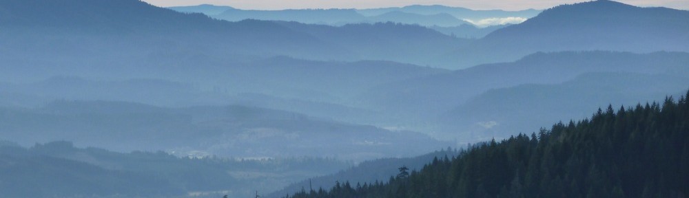
and the views of and from the summit were pretty restricted by the bad weather that we were having

“View” to the NW from the summit.

Summit meadows, looking towards Lobster Cr.

More summit meadow.

Our Friend, Mr. Gabbro.
On the way down we had a nice view into Lobster Cr., and alien signs:


And the recently industrialized landscape of Coleman Cr.
