The Logging Road Cyclist had been lollygagging about out by Valsetz and closer to town for the better part of the summer. Part of this was the result of TLRC’s excessive sense of public responsibility during the pandemic, which had lead him to places close to home (where they had been asked to stay by the authorities), and part of it was because he hadn’t felt up to the more substantial efforts required by some of the more distant and difficult rides. TLRC leaves it to the reader to judge how the reasoning was apportioned…
Like a lot of people, as the crisis dragged on and became more of a lifestyle, TLRC felt OK about wandering further afield. He also felt healthier and able to ride longer. This lead to a prosecution of the S Santiam Wagon Trail via the divide, and the more profound Blue River/1509/15 loop. An hour with the Sweet Home District map later yielded three pretty obvious routes into the region bounded by highways 20 and 22. Two seemed pretty severe, one pretty reasonable, so to the latter TLRC went.
The region is dewatered by 4 main rivers: S Santiam, Middle Santiam, Quartzville Cr. and the N Santiam. All of them contain some sections of prime whitewater. On the east lie the peaks of the Old Cascades; from them towards the west are the ghastly wastes of both private and public timberlands. Here also, in a desperate irony lie the Middle Santiam Wilderness, a profound remnant of pure old growth, and the Wild and Scenic section of Quartzville Cr., a section of river seemingly as pure and beautiful as any TLRC has run, as long as one ignores the savagely cleared-off slopes adjacent its banks.
For his first bicycle trip here, TLRC chose to climb out of the S Santiam canyon (always a lot of work) via the main 2047 road. It’s less than 3 miles and about 1000′ to the divide.

From there, one drops down to the Middle Fork.


From the bridge over the Middle Fork, a short steep climb leads to the junction with the 2049, the way back. With a bit more persistence, one could head up the the S Pyramid trail and look at some nice trees.
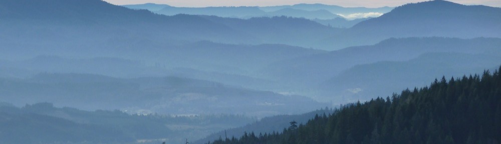
The 2049 is pretty heavily logged, but the extra length back to the divide means it’s middle-ring all the way, instead of the backtracking grind retreating on 2047 would entail. There are also some fine views of some of the Old Cascades Peaks.


