Dog Days

After the Bigfoot Ride, a strange lassitude crept over The Logging Road Cyclist. He had been on the road a lot this summer and the driving was wearing thin. Perhaps the stress of cat/ape threats looming through the trees had taken their toll. At any rate, the comforts of a smooth road ride on a summer’s day, enjoying the new fit on the Merlin that let TLRC crank out a quick 30 or 60 miles had its attraction. No navigation or beasts to worry about, just a straightforward ride, no pack, no reservoir, no map.

Thus a few weeks passed, until one hot afternoon, TLRC rode by a rolled car on Fern Road, just out of Philomath. He must have missed it by minutes, and who knows what would have happened had he been there at the right (wrong) time. Clearly the driver took the curve too fast and lost it into the embankment. TLRC slipped by the gathering crowd before the emergency crews arrived to close the road. Soon enough, one by one, three police cars roared past going way too fast for what appeared to be a non-injury accident.

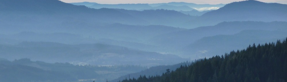
This got TLRC back to pondering why he likes gravel. Too much steel passing way too close and fast on the roads. Off he went to Waldo Lake, where he met up with the oldest buddy of all, Old Stumpy, for a ride around the Lake.

The Stumpster takes in Waldo Lake.

TLRC hadn’t ridden here for years, and had forgotten both how beautiful the Lake is, and how good the ride. Oh Yes: NO BUGS. On the way, they ran into a runner and his sleek buddies:

Wolfgang und Hermann

Wolfie was pretty friendly, and even sat on TLRC’s feet like a spaniel. Hermann less so. TLRC would have named them Hermann and Goering, were they his.

Just prior to all of this, was a Rogue River trip with The Long Suffering Girlfriend and her granddaughter the Bird Princess (whom TLRC thinks of as his Common-Law-Step-Granddaughter). TLRC broke his long standing vow never to go down the Rogue in the summer. There had been a number of experiences not to his taste, e.g., belligerent redneck families demanding to share a campsite, boom boxes, lines above Blossom Bar and the the boat ramp, etc., etc., etc… They had a great trip! With a bit of care taken when choosing nice and very small out-of-the-way campsites and an early take-out, no hassles! BP entertained all by swimming in the river and nearly causing TLSG a nervous fit, while dragging a dead salmon around and poking about in its mouth and gills.

It was a happy group who headed north over the pass from the take out to Powers. It’s quite a pull up to Agness Pass, and partway up, TLRC’s trusty ’97 Tacoma finally had a problem and overheated to the point of undriveability. In mile-long spurts they finally made it over and coasted into Powers.

Powers is a decaying Coast Range logging town, and it is desperately poor. The population is declining and is now around 600 souls. Logging is still stripping the rich hinterlands, and the trucks haul the bounty right through town, leaving nothing for the residents. TLRC and the gang pulled into town, and lo and behold, there was an open, functioning garage. Ready to take a big hit (really, what a mark, an overheating old truck pulling a heavy trailer home on vacation: TLRC could visualize the mechanics salivating), TLRC walked over. The greeter was a Rastafarian with a gold tooth, who told him (TLRC) to pull the truck over.

Next out were the proprietors and their hounds, Buck (redbone+walker) and little girl Weirdo (walker). They guys looked like mechanics on The Discovery Channel: shaved heads, tats and piercings. They had a few things to try, quoted TLRC a price and said the parts would come in tomorrow.

TKRC, TSLG and BP vowed to make the best of it and settled into the pleasant Powers county park, a quiet place built over an old mill site. They supped on burgers and fries in the small cafe, where the waitress, a girl of BP’s age or so, was so taken by BP’s emo styling that she asked shyly “Are you going to school here this year?”, perhaps hoping for a cool friend for the coming term.

After dinner they strolled through the park and found one of those “death to children” playgrounds that progressive places like Corvallis have done away with long ago, but that brought up fond memories for TLRC and TLSG. Two of the little foot-severing vomit-machine merry-go-rounds, teeter-totters made from steel pipe with sharp finger-chopping fittings at the pivot, high swings, slides coming out of a ten-foot high tower, and the Powers piece de resistance: a living room sized, 4 foot high concrete block with an attached block that rose another 5 feet or so, perfect for jumping and all manner of orthopedic distress.

At the park were a couple of boys, 5 and 7 (as they learned), armed with plastic combat knives, water cannon, camo-covered Warsaw Pact helmets, and a generally wild attitude: The Barbarians. Watched over by a truly long-suffering mother, they were almost completely out of control, and drew BP into their frolic with huge enthusiasm.

Bird Princess and the Barbarians

TLRC and TLSG sat with TLSM for about an hour watching the three of them flirt with serious injury. It was definitely one of those “… that’s alright until someone gets their eye poked out…” situations. The adults could barely contain their laughter while the Barbarians pounded BP, threw sand at each other’s faces, and played with all the death features at the park.

Exhausted, they returned to their site, where TLRC chatted up a pensioner riding around on a brand new Surly fat bike the guy had just got. “Spent my whole Social Security check on it!”

The next day, the mechanics labored away on the truck and finally concluded that it might work out with what they had done, or it might need a new radiator. TLRC thought it was time to move on and give it a try without. He offered them more than the estimate, since they had put in much more time than they predicted it would take, but the mechs were adamant in their refusal. “We’re here to serve the public, not rip them off.” They meant it too. Honest guys. The whole Powers interlude actually made the trip.

They were right about the radiator. Ten miles out of Camas Valley, TLRC finally gave up the ghost and they got towed to Roseburg, where the radiator was indeed replaced.

Back home, some road rides, some local MTB and TLRC had an itch to get out again. He wanted back in the woods and wanted some quality time with Devil Puppy, who missed the Rogue trip in favor of BP. Off they went up the Middle Willamette, into the smoke of the big, long-lived Deception fire. TLRC and DP hiked from Timponagas Lake and ascended Cowhorn Mtn.

Devil Puppy checking it out just prior to her First Known Ascent By A Show-Grade English Springer Spaniel of Cowhorn Mtn.

Of course, there was swimming to be had:

and a nice nap in the pumice sand at the precious Indigo Lake.

The next day, after a pleasant camp down in the valley, they nearly (TLRC having grown almost as uptight as TLSG about DP scampering off a cliff) got to the top of Sawtooth Mtn, but contented themselves with a view of the summit from a hundred feet away, followed by more downtime at Indigo on the way back. A delightful, non-bike outing.


Bigfoot Country

After a couple of weekends of Oakridge riding (MTB and X), The Logging Road Cyclist felt it was time to get out and do some exploring. He was drawn back to Rhododendron Ridge, with its high, isolated feeling and fantastic views. The fact that the R. Ridge trail was part of the old Skyline system gave the whole thing a nice historical feel. As usual, the Google helped to guide things. An MTB site pointed out that the Burnt Granite Trail might be used as part of a loop.  Thus the plan was formed: park at the bottom of the 4670, up the 46 to the 6350 and Rhododendron Ridge, then further north to Burnt Granite and down the trail back to the start. Some more surfing informed TLRC that the Burnt Granite Trail was a haven for lots of cats, who liked to lurk in the dense rhodie forest, and further advised him Not To Go Alone.

Along the way, TLRC encountered this site, which really opened his eyes to a lot of possibilities. TLRC, having spent a lot of time in the Klamaths, was vaguely familiar with Bigfoot lore, in particular the famous Bluff Cr. film, but he had no idea that there is a whole local scene. This discovery put the ride in a whole new light. The Burnt Granite- upper 4670 Rd. area is a nexus for Bigfoot. In 1967, a logger wandered off a work site and saw a Bigfoot family scrounging for food in the andesite talus up on Burnt Granite Mtn. There is a big pit they dug, as well as piles of stacked rocks. In 2005, while camped at a rock pit on the 4670, high up Lowe Cr., three men had two sightings, including one wherein BF stood over a restive camper, looking down into the pickup bed where said camper pretended to be asleep.  Local geographic features suggest this is not the only Bigfoot spot: Ogre Cr., Tarzan Springs (where, in the 1920’s it was reported that an old man was living “with a band of ape men”), Devil Lake. More advice is given: this is not an area to travel in lightly: it is remote with rough roads, traveled by “armed and unpleasant” people (as opposed, TLRC mused, to “armed and excessively polite” people). First cats, now this. TLRC felt a frisson of disquiet. His plan decreed that he pass through the exact center of Bigfoot ground zero. This could be a real adventure, if all turned out well.

Thus, a bright cool morning found TLRC spinning up the scenic 46 road towards the Breitenbush-Clackamas divide. Up ahead, he saw another cyclist, going slow and hauling an odd looking trailer. Pulling up, TLRC encountered a pleasant young Frenchman. This man was pedaling from BC down to the Burning Man Festival, and was not taking the easy way. He’d come over White Pass up by Rainier, then up again over the shoulder of Mt. Hood to Timothy Lake, bound for Detroit and Bend. While stopping to pick cherries up in the Methow, someone had backed over his bike trailer and wrecked it, so he bought a frame for a small trailer intended for a car, and built it up for the rest of his trip. He said it weighed 130lbs loaded, hence the low speed. TLRC was overwhelmed by this display of sheer grit and toughness, and it took him a while to recollect his manners.

“Oh,” he said, extending his hand, “I’m TLRC”

“My name is Damien” the cyclist replied, shaking TLRC’s hand.

O-M-G, thought TLRC. All this Bigfoot stuff, Devil Lake, and now this? Feigning a sneeze, TLRC dropped Damien’s hand like a hot coal, and turning, made a discreet sign of the cross, which settled his nerves enough so that he could remain with Damien for a polite interval before pleading that he had some ground to cover, and had better be off at his unladen speed.

Damien, en route to Burning Man, with a heavy load.

It’s 16 miles of moderate climbing from the 4670 to the start of the Rhododendron Ridge Trail. TLRC found himself enjoying the Trail more than the last time, even with the thought of large fanged cats hiding beneath all the rhodies, salivating  at the thought of a TLRC canapé. TLRC whistled his way along the trail, the better not to surprise them, and tried not to let the serene, sun-dappled forest become in his mind a sombre dark thicket, pierced by fearsome shafts of unbearable summer sunlight, serving only to blind him to what might crouch ahead.

Bye and bye, he reached Graham Pass, and set out along this new section of the Trail, here a trace gouged out of the second growth, paralleling the road. After a few hundred yards, TLRC took the easier path, and stuck to the road. He was unable to find the Trail again, until it appeared in a mile or so, at which point TLRC lacked the fortitude for more uphill trail punishment. He stuck to the road, and headed for Burnt Granite.

Along the way to the next trailhead, the road passes above the site of the 2005 Bigfoot encounters, giving a box-seat view of the scene.

The 4670 swinging into Lowe Cr. The rock pit where the 2005 BF encounters occurred is at the bend on the right side of the photograph.

View NNE past Burnt Granite to Mt. Hood. The 1967 BF encounter occurred at the end of the ridge closest to the camera. Tarzan Springs lies near the 4670 at the base of that ridge.

Collecting his nerve, TLRC picked his way down a diminishing, rocky road to the supposed trailhead for the Burnt Granite Trail, only to find an evanescent line of old orange flagging leading off into the brush. Loath to bushwhack into a Fundamental Axiom violation in unknown cat- and ape-infested country, TLRC contented himself with a scramble up to a talus slope with a view. Feeling a twinge of panic from being out of sight of his bike so close to an Encounter, and wondering what he’d do if it was gone when he went back to where he had left it, TLRC soon hurried back, ground his way up the road and bailed out down the 4670, which took him right by the 2005 BF rock pit:

Bigfoot was right here.

Sliding past Tarzan Springs, TLRC pondered mounting a search for the Burnt Granite Trail, which might be accessible from there, but it was just too easy to coast. To cap off all this excitement, the bottom 5 miles or so of the 4670 is simply beautiful single lane pavement, and provides a nice rush to end an exciting ride.

Ride Around Tidbits Mtn.

Ever since The Logging Road Cyclist turned his attention to the Santiam-McKenzie divide, he has had his eye on this loop around Tidbits Mtn. Like the other rides in this area, it has beautiful forests, striking views both up into the High Cascades and down towards the Valley, and brutal climbs. This is a worthwhile loop, but eat your Wheaties for breakfast. At 46 miles and 10,000 feet of climbing, it takes some doing, and some energy. The ride starts in Canyon Cr., crosses to the upper reaches of the Calapooia, climbs up and over to the Blue River drainage, and then hauls itself back  to Canyon.

Navigation is blissfully simple: follow roads 2026, 2820, 1510,1509 and 2022 back to the start. At every critical junction there is a clear road sign. One could almost dispense with a map. It seems that the Willamette Forest is more fastidious about their signage than the Siuslaw, or perhaps the local fauna are just less inclined to steal or shoot to bits whatever signs the authorities choose to erect. The (for once) adequate road markings are a relief: the first ride around this loop took some serious insult to the Fundamental Axiom, given the long and steep nature of the descents one would have to reverse in the event of a retreat.

There are some pretty creeks along the way, the usual breathtaking steep canyons, and for TLRC on this trip, a cougar, who, having crossed the road in front of TLRC had stopped to sniff the daisies until he (TLRC) whistled, at which the cat took off. Of course, TLRC had to pedal up the hill past where the cat had taken off, always a bit unnerving, even knowing the cat was likely long gone.

This is an excellent and serious ride. Go do it!

Valley of the Calapooia, from the 2820 Rd., just prior to the cat.

A crucial junction, just post cat. Absent the unambiguous sign, TLRC might not have dropped off down this one. It’s a Long Way Down.

The steep country below the 1510. Tidbits Cr. in front, Blue River behind, Three Finger Jack somewhere back there.

Rhododendron Ridge Trail Ride

A couple of years ago when he did the Rhododendron Ridge Loop, The Logging Road Cyclist felt sad that he had no mountain bike with which to go back and explore the Rhododendron Ridge Trail. Well, he has now, and with shiny new red rims to boot. Thus the first real backcountry test of his wheel building skills was just that ride.

Granted, TLRC did not take the most rational approach to the RRT this time, but he was nostalgic for the Humbug Cr. start and the climb up the 4698 Rd, with it’s healthful climb and great views. He had forgotten just how steep it, and the final climb up to the Ridge actually were, and how much real MTB time they would consume. Next time, he will probably explore a couple of other sections of the RRT, and take a more direct start up the 6350 Rd., right off the pass between the Clackamas and Breitenbush.

This ride covered that part of the RRT between Cachebox Meadow and Graham Pass. It’s a nice and moderate sort of trail that even TLRC rode most of, walking the occasional steep-ish or rocky part, he ever mindful of incurring excessive fatigue on a hot day, or injury way out there by himself. There are spectacular views of the High Cascades,

Jefferson, Three Finger Jack and Washington from the Rhododendron Ridge Trail above Cachebox Meadows.

and lots of nice rhododendron-y forest:

From Graham Pass, it’s a pretty easy spin back in your middle and big rings along the 6350 with a lot of very nice views to the north.

St. Helens and Hood from the 6350.

Back at the pavement 9 miles of fast downhill lead back to the start. TLRC got up to nearly 40mph on his new wheels, and they were solid, dude, like being on a rail. He is coming back for more soon.


TLRC Pimps His Ride

Many have the impression that The Logging Road Cyclist is a mild-mannered, suburban milquetoast sort of fellow. This is certainly consistent with his retiring, perennially polite and self-effacing manner. Little do they know about the beast that lurks within.

For example, TLRC’s vehicle of choice is sensible and efficient, chosen for practicality rather than style:

In his dreams, though, is quite another thing:

But a dream is just that, and TLRC faces the fact that he has neither the courage nor the money to get the ride of his dreams, and he has to make do as he can.

Red Velocity Blunts laced onto Chris Kings

At least the reality has the same color wheels as the fantasy.

Latiwi Mtn- Old Santiam Wagon Rd.

Another Sunday found The Logging Road Cyclist huffing his way up another punishing climb out of the SF Santiam River. This time the climb was up the 2044 Rd out of House Rock, and at the top, 9 miles away, was TLRC’s new favorite road, the 1509 (“Backbone of the Sweethome RD”!). His goal was a new take on the Old Santiam Wagon road, whereby rather than use a car shuttle, he would ride it as a loop. The serious climbing ends at the junction of the 2044 and 1509, after which the ride rolls along the Santiam-McKenzie divide through beautiful forest and with great views to the High Cascades and some big peaks way out over by the Brietenbush.

The big climb is not without its charms, eg. Three Crrek:

which tumbles down out of wonderful forest on its way to Latiwi Cr. far below. After the 1509 junction, the ride gets easier and the real views start.

View back to last week’s objective,Tidbits Mtn.

Sisters

Looking north off the 1509 towards big peaks above the Breitenbush.


Browder Ridge, etc.

The 1509  rolls along, passing beneath the face of Latiwi Mtn, on it’s way to the junction with the paved 15 Rd, after which it’s a piece of cake down to Tombstone and the Old Wagon Rd. Moderate single track varying from scruffy to beautiful takes one back to House Rock.

On the Old Wagon Road.

This 30 mile, 4700′ loop is certainly more strenuous than just riding the trail and doing a car shuttle, but the major 9-mile climb pays big dividends in terms of some exercise, lots of great views and some very nice Cascades forest.  A wonderful ride for a summers’ day!


Tidbits Mtn Traverse

Following the way pointed by D towards the Santiam-McKenzie divide (cf. Wiley Calapooia Loop), The logging Road Cyclist immediately got to work with his Sweet Home Ranger District map and found an obvious goal: Tidbits Mountain. Sitting at the top of (counterclockwise from north) Canyon Cr., the Calapooia, and a number of big, steep canyons that feed into Blue River, Tibits is accessible  by some single track, after paying the entrance fee of a long gravel slog. Tidbits itself was recommend by various sources as a nice hike with a rewarding view, so TLRC figured at the least he’d haul El Mariachi over a few miles of trail, and perhaps get to ride some, with luck.

Leaving the truck at the bottom of the 2032 Rd., TLRC scrambled down Hwy 20 to Canyon Cr. early in the morning before the death traffic could get him, and while the morning sun lit him up and didn’t interfere with drivers’ vision. Turning up Canyon Cr. on the 2022, TLRC got to relive some old boating memories.

Canyon Cr. is the closest serious class V run to Corvallis, and TLRC did it with some local boating celebrities about 15 years ago. This was after TLRC had spent ten or so years open boating with the wives. Not only had he been out of a kayak for that time, but the world had moved on. Shorter, safer boats were the rule, and TLRC soon realized he was nowhere near the top of the boating heap anymore. Canyon was the first real thing he had run in all that time and it was an eye opener. While scouting the biggest scary rapid, TLRC must have looked concerned. One of the celebrities, whom TLRC had known slightly during The Glory Days of yore came up and said quietly: “No, we didn’t use to run things like this.”, which TLRC took as an act of kindness, and a change from the usual, male, devil-take-the-hindmost attitude one encounters on this sort of run. It turned out not to be so bad. The new boats helped.

The Big One on Canyon Cr. Low water and distance disguise its true nature.

TLRC knew it would be a pull up to Tidbits, so he got into his climbing zen. The ride was mostly through surprisingly nice forest, which helped, since it turned out to be basically 20 miles and about 4000′. Navigation was straightforward here with well-marked roads whose numbers corresponded with the map. After a while, the Objective hove into sight:

Tidbits Mtn. from the 3398 Trail.

There was a great view down into the Calapooia as well:

The trail was certainly rideable, except for a few downed logs that were easy to get over. TLRC rode as much as he felt he could and still have enough oomph left for the end of the ride.

Looking down Canyon Cr. A long ride up to here.

Trail and talus slope, near the top.

After a while the summit trail branches off to the right. Stashing the bike, TLRC joined some hikers at the top.

Looking south into Blue River drainage from the summit.

High Cascades from the summit.

Beyond the summit trail are some rocky sections above long, steep talus. All of this is rideable, but not by TLRC. Soon an indistinct trail junction appeared. TLRC had planned to take the eastbound branch directly to the 1509 Rd., but the trail was so overgrown and under-maintained that after a 1/4 mile or so he called it quits and headed down the main trail to meet the 1509 on the Blue RIver side of the divide. A short, very steep branch road lead down from the trailhead to the 1509, where TLRC turned left. Unfortunately, this road, while “obviously” being the correct one, was unsigned in this section. Having played this game before, and not at all wanting to have to retreat back over Tidbits, TRLC got more and more worried as the road rolled along, gradually losing elevation that would have to be painfully recovered if, as so often in the past, he was wrong about it. Nevertheless, the views were spectacular. The road contours along the headwaters of a number of tributaries of Blue River, which are amazingly rugged and steep.

Blue River Lake and Cougar Reservoir from what turned out to be the 1509.

After 5-6 miles of stomach tightening uncertainty, TLRC found the intersection with the trail not taken from the top, proving that this was in fact the needed 1509 Rd. Pumping his fist in relief, he headed off for the next goal, Bear Pass.

Just about then, TLRC was starting to feel pretty tuckered out, and pretty mad at himself for feeling like this after only 30 miles or so. He was slow on all the climbs to Bear Pass, above the 15 mile (pretty much) downhill slide to the car. He stopped and sat stupidly in the sun, eating and drinking and wondering if this was aging or a lack of fortitude. Collecting himself, he rattled on down to the car, thinking how much more cushy the 29er was that the old DeSalvo.

This is a wonderful, scenic and adventurous ride, and tougher than it looks. On getting home and viewing his track, TLRC felt better about himself. The ride is 48 miles long, and since the last 15 are downhill, one climbs most of its 7500 feet in the first 33 miles, which TLRC thought was reason enough to feel tired.


Imperfecta Abominatio

The Logging Road Cyclist doesn’t get out much. He keeps to himself with his nose to his private grindstone. In short, he often doesn’t have much of an idea of what’s going on. Somehow he heard about this death ride in his on bailiwick, The Abomination. Seventy miles and 10K of climbing. Clearly this was something that needed to be done. Besides, this cleverly put together ride includes some new country for TLRC, roads north of the Yachats River that he had wanted to check out.

Rather than follow the whole route, TLRC started on the Yachats River so that he could cover the parts unknown to him early in the ride so as to avoid dropping into unknown pits when exhausted toward the end. This starting point also gave several shortcuts back to the car in case he wanted to stop early.

Good thing, a logging operation on the 3210 blocked access to that part of the ride, and the section along Five Rivers Rd.


TLRC has learned the hard way that in spite of his charm, manners and “only being on a bike” loggers don’t care, and just want you out of their way, and get really irritated when you ask to pedal through their operation. They have a point, and TLRC now lets them alone. Lassitude and logging trucks on the 58 led him to shortcut down the 54 and go home. Even so, what he did ride was through some of the prettiest country the Siuslaw has to offer, and he hopes to get back and do the whole thing at some point.

Wiley-Calapooia Loop

The Logging Road Cyclist is considered by many to be a man of bold vision. While he appreciates this accolade, he knows his limitations. Once new territory is staked out he tends, in his methodical way, to want to tidy up, to be sure all the little nooks and crannies of a new area are all sorted out and stored away in the TLRC repository of gravelly knowledge. He also has his training agenda, and feels compelled to try more and more unpleasant feats in order that yet more unpleasant feats may be accomplished, &c.

Last week, TLRC was pondering his next venture. Foremost in his mind was a return to the Siuslaw to ride The Abomination route so as to consolidate his mental map of the regions north and west of the Yachats River and 58 Road, respectively. Also, it sounded like such a punishing ride that TLRC was sure that on completion he would feel well satisfied and the voices in his head would subside for a few days, at least.

Thus TLRC, until a call from his buddy D. put him (TLRC) back in the exploration frenzy. Judging from the background noises, poor connection and slightly belligerent tone, D. was apparently consuming a beer in his bike-building shack out back, while at the same time suffering from a bout of having to know about the fishworthyness of Wiley Cr. and the Calapooia River. TLRC knew parts of both well from his boating days and signed up immediately, realizing he was becoming too set in his Coast Range ways, and  needed to expand the website, besides. Who had the vision now? Our man, D. On Sunday, off they went.

It’s not a long drive from Corvallis to McClun Park on the Calapooia Rd. up from Holley, and it’s a good place to start a ride. The pair followed back roads to Sweet Home and then prowled through the part of town seldom seen when heading fast up Hwy 20. Gaining Wiley Cr. Road, they headed up into the mountains. D had a Google map printout, TLRC a TOPO! section only for very high up the drainage with Forest Service road numbers inked in. They both figured, how hard is it to ride up Wiley Cr. and down the Calapooia?

Shortly after the first wrong turn, they were accosted by a guardian.

Inside the house were three more dogs, each with its own window. Collecting themselves, TLRC and D got on the right track and arrowed towards the divide, following scenic Wiley Cr. with its fun-looking drops.

A big drop on Wiley Cr.

TLRC had been expecting the usual private logging land moonscape, but was pleasantly surprised at the amount of foliage left standing.

Roadside view, Wiley Cr.

That said, the longer perspective shows the mix of industrial and recovered industrial landscape in the drainage.

Looking down Wiley Cr. from pretty far up.

The view the other way.

Towards the top, the road really starts to climb, and the team was uncertain about exactly where they were, owing to cartographic limitations. TLRC felt certain that a high point off to the SE was the height of land, Green Mtn., and pointed it out to D who, in his usual direct way stated that he really liked it when TLRC started “pointing at random shit like you actually know where you are”, which TLRC felt was as unkind as an earlier comment about “little trees“.

At any rate, by and by they obtained the crest, where, thanks be, there were actually road signs that had numbers that corresponded to the map TLRC had inked in the night before. Here was a serious case of Fundamental Axiom breakage: dropping down an unknown road for thousands of feet into another drainage and nearly 20 miles back to the truck.

It felt pretty solid at first: a good road sign, a single forest road of good quality, a huge drainage that could be nothing but the Calapooia, bright clear weather. But then the trees stopped, the road ramified into the usual maze and suddenly the possibility of dropping a couple of thousand feet into a dead-end landing became very real.

Looking into the Calapooia from near the divide.

About then, at least fifteen miles in from the last gate, TLRC started to wonder how much more climb they had in them, if their bike maintenance was really up to snuff, why he hadn’t bothered to bring along the spare tire, and why situations like this made these not like “regular” bike rides.

They sucked it up, and mindful of past problems after violating the FA on the backside of another Green Mountain, they skittered down the rough, loose road without a whole lot of mirth. An obvious road intersection-creek crossing gave some good nav, an obvious drainage some more, and then the best sign of all, a locked gate, meaning that most likely there wasn’t a landing on the other side. Indeed, a few minutes found them pounding recklessly down the ball-bearing like surface of the Calapooia Road.

It took them a lot longer than they thought it would to get back to the truck, but they did, after nearly 60 miles, well pleased with themselves (and with D especially) for putting together this great ride.